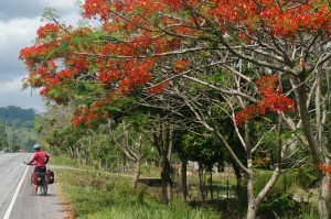
Central America Route Notes
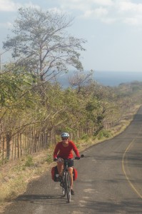
By popular demand, here’s the approximate route we took on our five month cycling trip from Panama to Belize. As well, we’ve written down detailed route notes below, by country. We tried to take quiet backroads when possible, to stay off the Pan-American Highway, although this “highway” is sometimes as quiet as a small backroad. This is the “dry” version, focusing on the technical details: which places we stayed at, roads we took and would recommend (or wouldn’t recommend!), and some food recommendations. This post would probably only be interesting for people planning to cycle tour in Central America. We also have the much more interesting blog posts about each country (see links below), as well as the mini-guidebook to cycle touring in Central America and a short video clip. We relied mostly on paper maps for navigation, either the excellent ITMB maps or National Geographic Adventure Maps (all of which we brought with us).
View Panama to Belize (cycling) in a larger map
Panama (Part I and Part II)
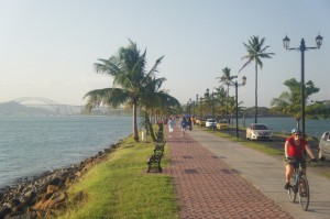
Panama has excellent back roads, many of which are smoothly paved. We figure it would make a good destination also for a 3-4 week trip, possibly using a bus to get back at the end (for example, from David back to Panama City). For places to eat, look out for fondas (small eateries) on the side of the road, and coconuts all along the coast, called pipas. When in Panama City, cycling along the waterfront between the old city and downtown is worthwhile, as is cycling out along the causeway to the islands of Naos, Perico and Flamenco (lots of pedestrians and cyclists), although be prepared to pass through a slightly sketchy neigbhourhood. Don’t forget to check out the amazing fish market (ceviche for just over $1!) where we ate literally every day.
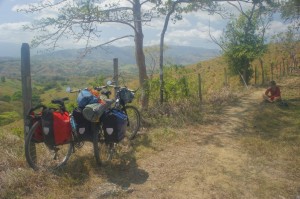
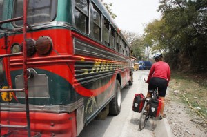
Leaving Panama City on the Pan-Americana was by far the worst cycling of this trip – lots of fast traffic, a big highway really, variable shoulder with lots of trash, a bit of a shock. It took most of the day (or more) until we were far enough away to start enjoying the riding. Consider taking a bus, maybe as far as Capira. The mountain road to Chicá is beautiful although it ascends at least several hundred meters. From Chicá you can continue to Buenos Aires via a steep and rough unpaved road, and then connect back to the Pan American Highway. The road passes through the Altos de Campaña Park, where there are hiking trails and you can camp (there’s a ranger station at the entrance).
The ride to Punta Chame is very nice, it’s a small village and a resort, at the end of a causeway, popular with kite-surfers (beware of the strong wind). It is possible to camp on the beach, or on the resort’s property on the beach (and use their facilities). We then rode up into the mountains to El Valle, another steep uphill to a town located in the crater of a volcano. It’s a nice place to spend a few days, take in the scenery and do some short hikes. From El Valle there is now a mostly good paved road that leads to Penonome, which might or might not appear on your map.
We spent several days cycling the peninsula Azuero. Pedasí is a pleasant although touristy town, and the nearby Isla Iguana Wildlife Refuge has frigate birds and snorkelling (head to the wharf to negotiate a boat ride). The road from Tonosí to Ocú was very nice but also very hilly. The road from Santiago to near Las Lajas is recommended, a very quiet road with smooth pavement. The detour from Soná to Santa Catalina (and back the same way) was marvellous, a small (but paved) and magical road that keeps on getting smaller until you reach the village and ocean, right at the end of the road.
Santa Catalina is very touristy but peaceful, we stayed for a few days and took surfing lessons. Accommodation is a bit expensive, but we camped for $5 per night on a grass patch by a hotel, with glorious views of the ocean. Back on the highway, the approach to David, was quite busy already from 50 km away, so from David we took small quiet roads, through banana plantations, to the Costa Rican border, which avoided the busy main road.

Costa Rica
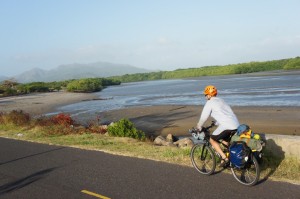
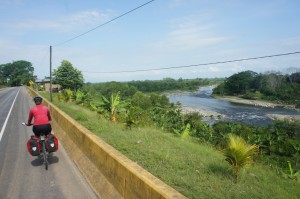
The coastal road (#34 on our map) is a pleasant ride, not too busy, with nice scenery and some beautiful beaches along the way. Check out the spherical rocks at Palmar Norte, and the special Manuel Ballena National Park (at low tide you can walk way out onto a cool land spit), but we avoided Jacó, as it is reportedly teeming with tourists. Orotina is a nice small town with a lively market and a fruit festival (check the dates). It is also in Costa Rica’s zona de mango (The Mango Zone), where there are mangos most of the year (reportedly), and there are many fruit stalls on the way in and out. The highway from Orotina to Puerto Caldera is an easy ride on very smooth pavement with good shoulders, although we ignored some signs prohibiting cycling on this road.
We caught the small ferry from Puntarenas to Playa Naranjo and explored the Nicoya Peninsula for a week. Most roads are gravel, which is at times rough and steep, but doable with hybrid/touring bikes (expect to spend some time pushing). The tourist hangouts (which we tried to avoid) are Montezuma, Santa Teresa, Malpais and Sámara. The rest of the coastline is largely undeveloped with beautiful long stretches of sand. Some sections can be ridden at low tide – the sand is hard and much easier to ride on than the road (and it’s an amazing experience as well). As far as we remember, we rode from Manzanillo to Caletas and from Punta Coyote to San Miguel. The “town” of San Miguel is tiny, but it has a beautiful long stretch of beach, and you can ask for permission to camp in the backyard of the store, right by the beach.
From Sámara we left the coast and headed on a paved road (sigh of relief) towards Nicoya, Filadelfia and Liberia, where we connected with the Pan-American Highway. The stretch of road between Liberia and La Cruz is desolate and remote with very little traffic and almost no sign of humans (carry enough water and food!). La Cruz is a nice town, we took a day trip by bike to the nearby beach, Puerto Soley. The road to the border, around 20 km’s away, was pleasant and had little traffic.
Nicaragua
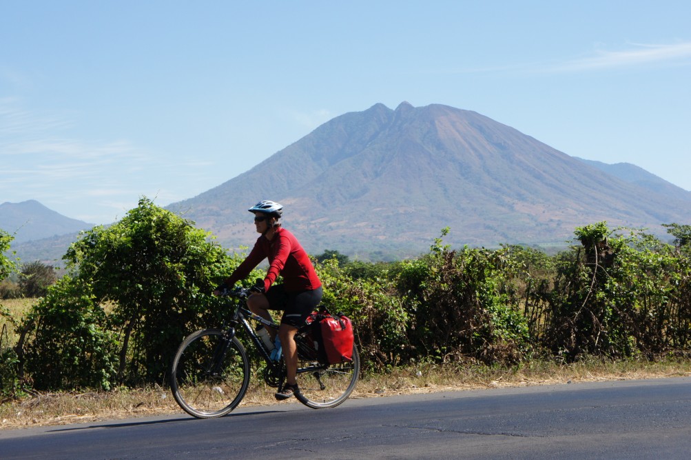
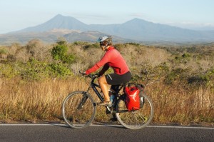
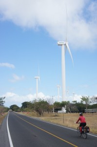
Nicaragua has some of the nicest quiet backroads (but not the smoothest), and some of the friendliest and most optimistic people. Many people head to Ometepe Island, and for good reason – it’s an amazing place. The road from the Costa Rican border to Rivas (check out the lively market), about 50 km’s away, which follows the huge Lago de Nicaragua, was very windy (and is lined with wind farms) but the traffic was light.
We caught the ferry to Ometepe from the nearby San Jorge – there are frequent ferries. On Ometepe, there are few roads, most of them made of bricks (quite smooth though). We cycled to Balgue and spent some time there, staying at the locally owned Asi Es Mi Tierra (check out the impressive mural). The road around the south side of the island is supposedly extremely rough, and we rode a short section of it when we went to Merida. We rented kayaks to visit the mangroves and to see great views of the volcanoes, on a nice day, as well as some village life on the water.
We took the night ferry to Granada (runs only twice a week) which was no trouble, although the ride there at night, was very dark and scary. We spent some time in Granada and nearby: at the market, Laguna Apoyo (excellent swimming in crystal clear water), the steaming Masaya Volcano, kayaking to Isletas (a group of inhabited tiny islands) and just admiring the buildings and streets in the colonial quarter. Granada is also a great place to take Spanish lessons, a chocolate workshop at Pure, and don’t miss the amazing chocolate ice cream at the fancy ice cream place on the main pedestrian street, Montebianco (have the dark chocolate!).
When leaving Granada, we avoided the main roads by cycling to Tipitapa, taking the smaller road that parallels the main road to San Benito, where we turned off onto a backroad (recommended!). Boaco and Muy Muy are nice small towns, off the beaten track, we got lots of shocked stares on this road.
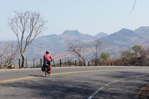
From Muy Muy we cycled to Matagalpa, and took the mountain road (the “old road”) to Jinotega, an excellent ride and views with lots of colourful vegetable and flower stalls on the way. We returned to the Pan American Highway via a small road through La Concordia and on to Estelí (where we had trouble finding a cheap place to sleep) which has a great organic market on Fridays. Somoto is a nice town, and the nearby canyon is a great hike and swim, you can stop for a tour on the way to the border. The ride from Somoto to the border was short and quiet but steep and the border crossing was small and easy.
Honduras (Part I)
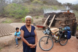
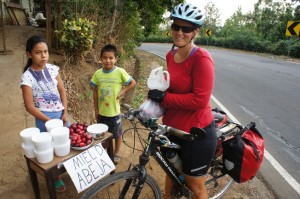
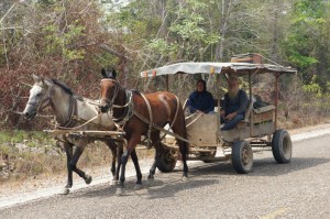
The first town after the border is San Marcos, about 10 km’s away, where we stayed in a disgusting dump (same for San Lorenzo). There is a long and very enjoyable downhill of around 30 km’s as you’re approaching Choluteca, which was incredibly hot, but at least we found an aluminium welder easily (to fix Maya’s rack). There are many pottery artisans along this section of road, check out how they fire their pottery in a wood fire, beside the road. In general, we followed the main road from the Nicaragua Border to the El Salvador border: there was lots of traffic from Choluteca to the turnoff to Tegucigalpa, but it was fine before and after that (note the incredible amounts of garbage along the road!).
El Salvador
In El Salvador we mostly followed the coastal road, Highway #2. After crossing the border there are no sizeable towns for a long way – we asked to camp in someone’s yard, but they were concerned for our safety and recommended we stay at the police station instead (which we did). There is a small recommended road that goes to Playa Esteron through Intipuca, with an unpaved bit at the end.

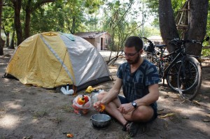
We camped at La Tortuga Verde below the mango trees – we collected and ate the newly fallen fruit every morning – heaven (there’s a pupusa stand 20m away – much cheaper than the hotel food). We then cycled along the beach (easy at low tide) to El Cuco and then back to the highway via a paved road that passes by Chirilagua. Look out for the red or yellow deliciously juicy cashew nut fruit, marañon, also available as freshly made juice (or make your own – just squeeze in your hands!). We took a bus from Usulután (we only found a dingy sex hotel) to Alegría to avoid a huge uphill, and spent a few days – it’s a nice little town, before coasting downhill back to the highway.
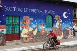
El Roble is a wonderful hostel near Playa San Diego, where we camped for two nights (although it was officially closed at the time). At Playa El Zonte we camped at Casa de Freida, right on the beach. We left highway #2 at the turnoff to Sonsonate and then cycled the Flower Route (Ruta de las Flores – highly recommended!) with its cute towns and colourful murals. After ascending around 1,000m you’ll be rewarded by arriving to Juayúa, a very nice town, where we recommend Casa Mazeta (ask for the room with the fountain). In Juayúa and nearby towns there is a lively weekend street food market. In Ahuchapan, which has many colourful murals, we had trouble finding a cheap room but ended up in an occasionally rented room above a pizzeria near the plaza. From there we enjoyed the downhill ride to the Guatemalan border at Las Chinamas.
Guatemala
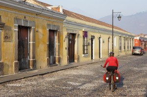
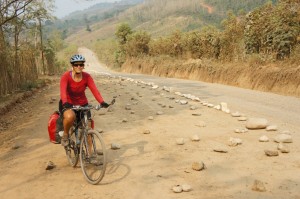
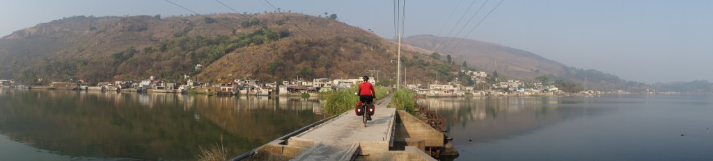
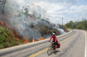
Guatemala has a maze of roads allowing more freedom on where to go, and our route meandered quite a bit. They also have some of the steepest grades we have seen anywhere. The food in Guatemala was a step up compared with the food in the countries south of there, it must be a Mexican influence. We took highway #8 through Jalpatagua, Cuilapa, on to Villa Canales, where we stayed at a disgusting mosquito haunted sex hotel. From there we crossed Lago Amatitlán on a cool little causeway, and then caught a pickup truck (to avoid the six lane highway) to Villa Nueva, and then on to Antigua (don’t miss the banana bread at Doña Luisa!).
From Antigua we took the highway and then a smaller road to San Pedro Sacatepéquez, where a pleasant quiet road starts (lots of colourfully dressed Maya people in this area). In San Juan Sacatepéquez we had a hell of a time finding a decent place to sleep, but ended up at the super nice bible camp. The market in the early morning was amazingly colourful and lively with people from the whole area.
The road through Chuarrancho is very nice, becomes small and unpaved at the end, and then ends at a large missing bridge over the Matagua River (the bridge can be seen further down stream). Depending on the water level, the river might be crossed on foot, there was also a person there ferrying people and gear across. We camped on the other side of the bridge and caught a ride up to Salamá, avoiding a horrendously steep section. Salamá is pleasant, we took a nice day trip to San Jeronimo.
From Salamá we caught a ride to Tactic and then took highway #7E which was being paved at that time. It’s a quiet road that passes through small villages and has nice views. The hotspring waterfall near Finca El Paraíso is something special. We stayed at a surprising colonial hotel in the somewhat ugly town of La Tinta. Rio Dulce is nothing special though, so most people stay a boat ride away, on the water (we stayed at Casa Perico).
From Rio Dulce we caught a boat to Livingston, a special place owing to the Garifuna people. We took a nice bike ride along the beach to the north, and then back on the road. We continued by boat to Puerto Barrios and caught a bus to Zacapa. From there it was an unbearably hot ride to Chiquimula and the Honduran border.
Honduras (Part 2)
We didn’t end up riding much in Honduras: after cycling to Copan Ruinas (just 10 km’s from the border) and visiting the famous ruins, I got dengue fever. Since we were about to volunteer at a bilingual school in Cofradia, near San Pedro Sula, we caught a bus there. It’s an unremarkable town, but staying with a local family and teaching at the school were good experiences.
We also spent a relaxing week diving on Útila, before returning to Cofradia. We didn’t want to ride through San Pedro Sula (the second biggest city in Honduras), so we caught a ride to the turnoff to Puerto Cortes and cycled to Omoa where we spent a night, and on to the border, a tiny outpost. From there we cycled into Puerto Barrios (again!) and took a boat to Punta Gorda in Belize – it was a ride from hell due to the high seas and a crazy captain who was in a hurry (mornings are supposedly better).
Belize
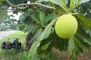
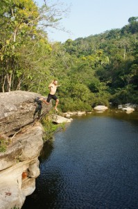
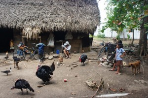
The roads of Belize are mostly boring, unfortunately, but they are mostly flat and there are many memorable places, sights and people in between, which more than make up for this, as well as the gorgeous Hummingbird Highway. The Maya villages of the Toledo district, near Punta Gorda, were a highlight for us, we cycled as far as Santa Cruz and on to the amazing swimming hole at the Rio Blanco National Park (excellent cliff jumping), and back to Santa Cruz to camp in a thatch hut’s yard (no electricity there). Look out for cacao drying in the sun and for cacao trees.
Back on the main road, we caught the ferry from Mango Creek to Placencia and stayed there for a few days, check out Tutti Frutti, an excellent italian ice cream place. From there we cycled along the narrow strip of land north, this area is being developed heavily, most probably for vacation and retirement homes for Americans. The road along the Sittee River and on to Hopkins is quiet and worthwhile, and Hopkins has some authentic Garifuna eating places as well as a cultural center where, if you are lucky like us, you might catch a drumming session.
We caught a boat ride from Dangriga to Tobacco Caye, where we spent a few days – it is a tiny island, with excellent snorkelling, and unlike the resort cayes, some Belizeans actually live on this island. We stopped at the Marie Sharp‘s factory just outside Dangriga – their delicious hot sauces are on every single table in Belize, and we had a chat with the son who works at the factory (apparently Marie is sometimes there too), where there are also tours.
The Hummingbird Highway is scenic and more hilly than most other roads in Belize. Look out for a Mennonite Dairy Bar with homemade yoghurt and ice cream. We stopped at the Blue Hole for a good swim and camped by the ranger station. The market in Belmopan is worth a visit, as is the Belize Zoo. Do not miss Dario’s Meat Pie Bakery in Belize City, where people line up for the steaming hot pies straight out of the oven, which are sold all over town. We had an extra two days to kill so we headed to the super touristy Caye Caulker (Belize City is not too exciting), and were pleasantly surprised – it is a very relaxed place, and we had an excellent snorkelling tour with Raggamuffin Tours.
The chocolate factories, which all use locally grown cocoa beans, were another highlight in Belize, and we made sure to visit any on our way as well as consuming many chocolate bars, check out: Cotton Tree Chocolate in Punta Gorda, IXCACAO just outside Punta Gorda, Goss Chocolate near Placencia, Che’il Mayan Chocolate in Maya Centre, and Moho Chocolate in Belize City.