Prince Rupert to Skagway: Looking for Sunshine
Cloudy
Some people say it rains a lot in Vancouver. I suggest them to take a trip, or better yet, a cycling trip to Prince Rupert, the rainiest and cloudiest city in Canada. In an average year, they get only 100 days with some sun and the total precipitation is 2552mm. But this year wasn’t an average year. It was a cold and wet summer in this part of the world. Ignoring all those facts, or simply not knowing the exact details, this is where Gili and I chose to start our cycling trip through Northern BC, the Yukon and to Skagway Alaska.

Like every great adventure it all started by chance. Different reasons led us to choose Northern BC as our destination this summer. I was really keen to do some sort of cycle touring up there and Gili remembered that he had once read an article that mentioned the Cassiar Highway as being one of the best roads for touring in North America. It is a remote road, without many services and very wild. We weren’t sure where to start and finish, but then we remembered someone saying that the way from Prince Rupert to Terrace is beautiful, along the Skeena River. Marcin suggested continuing all the way to Skagway, which would also solve the problem of getting back to our car, as we could take the ferry back. Perfect. Everything seemed to work out, except one thing: the weather. During the weeks before we left, the forecast always showed gray sky and rain. We decided to still go ahead with the plan.
Driving to Prince Rupert takes about 20 hours from Vancouver. Near Prince George, still about 700km from Prince Rupert, the skies darkened, and for the rest of the drive it rained on and off. As we were getting close to Prince Rupert the song “Cloudy” by Simon and Garfunkel was playing on the radio:
Hey sunshine, I haven’t seen you in a long time
Why don’t you show your face and bend my mind?
These clouds stick to the sky
Like floating questions, why?
And they linger there to die
They don’t know where they are going, and, my friend, neither do I

It couldn’t be a better way to describe the way we felt and those words stuck in my mind for the entire trip.
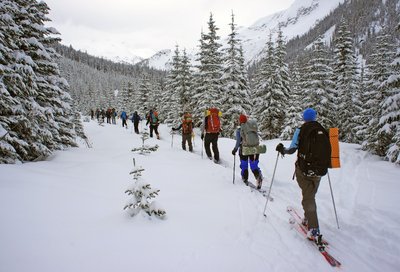
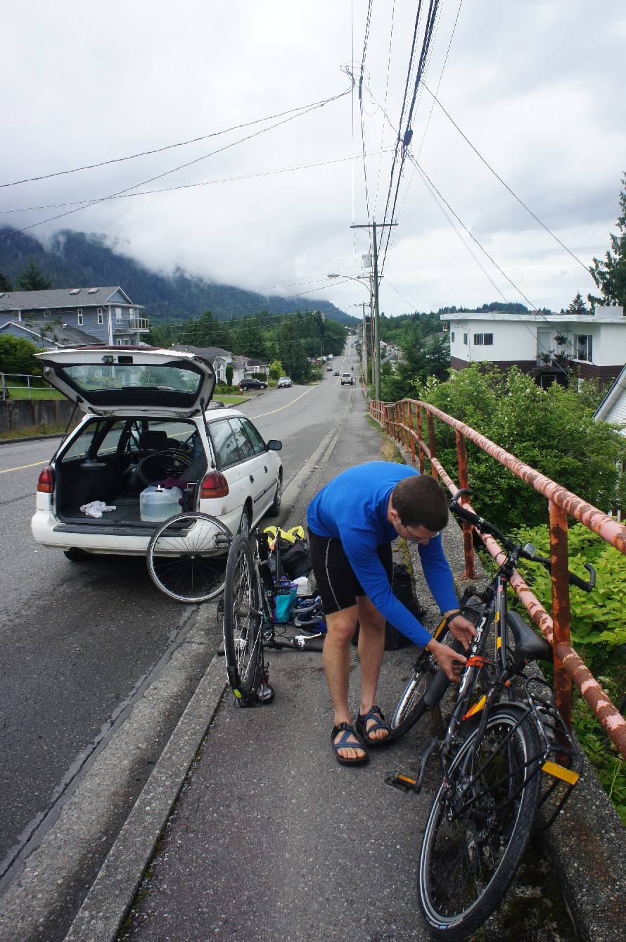
It took a while to find a place to park our car and to get everything organized. We finally started riding just after 1pm. The first couple of hours were really nice and dry. Then we stopped for lunch and it started raining and didn’t stop for about 24 hours.
We put on our rain gear and soon enough we discovered that there was one thing we didn’t think of – shoe covers. Within minutes our shoes got soaked. Riding wasn’t too pleasant. We reached a rest area and hid in the outhouse, it was the only dry spot we could find. Then we rode for about 20km to the next rest area. We decided to stop there for the night, even though we had only ridden 60km and it was still early. Gili declared that if it’s going to continue like this for three weeks he would rather quit now. Gili is usually the optimistic one between us. We were grateful that we had brought the tarp. We changed clothes, cooked dinner and went to sleep. Our hope was that it must get better, because it couldn’t get much worse.

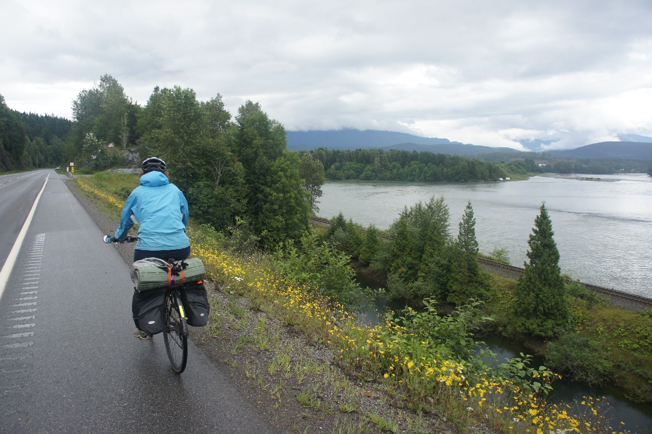
When we woke up it was still raining hard, so we slept in for two more hours. By then it felt that the rain calmed down a bit, and we packed up slowly. We rode along the Skeena, “the river of mist”. On the sides of the river we saw people fishing or smoking salmon. We reached Terrace in the late afternoon and noticed an event in a park on the side of the road. It was the Riverboat Days event of the Kitsumkalum nation, and the best part of it was that they were cooking salmon on the fire and selling it for $1 a piece. We finally felt like things are starting to pick up and we enjoyed 5 pieces of deliciously fresh salmon. As we were leaving, the rain started again, but this time the sun came out too and we rode towards a beautiful rainbow. Cycling in the rain finally felt worthwhile.

The rain had stopped and we said goodbye to highway 16 and the Skeena River and turned to the Nass (Nisga’a) Valley Road. We started looking for a place to camp and of course about 10 minutes before we stopped it started pouring again. Just after we came across a black bear we saw a small turn off to the Kitsumkalum Provincial Park. There were a few spots to camp there, although it wasn’t an official campground. Two families from Terrace invited me to join them by the fire and under their tarp while Gili was setting up our tarp. The fire was a blessing and the people were nice and friendly and curious about our trip.

Between the Lava Fields
Canada’s last volcanic eruption occurred in the Nisga’a valley about 250 years ago. It destroyed villages in the area and over 2,000 people were killed. Today this area is a provincial park with lava fields all around. We first cycled along Lava Lake which was created in the eruption. While we were having lunch the sun came out for real for the first time since we started the trip. I took the opportunity for a short nap in the sun. Then we rode along the lava fields which were quite incredible and the road had very little traffic.

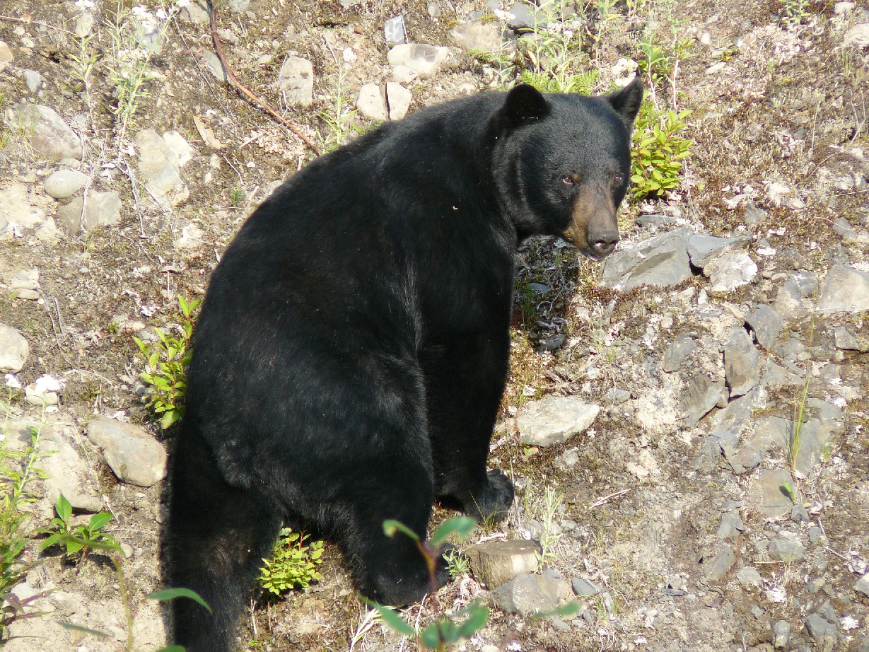
Every now and then we took a detour to see waterfalls or more lava fields. We also visited the village of Gitlaxt’aamiks where we saw impressive totem poles. Then the road turned to gravel and stayed like that for the next 50 km. But it was time to find a place for the night, so we turned to a side road where our map showed a recreational site, and there we had the closest encounter with a bear thus far. The road was very narrow with thick forest on both sides. On this part of our journey we saw many bears and indeed the Nass Valley is known as one of the largest concentrations of black bears in British Columbia. We did not find the campground on this road though, and we reached a dead end at a river with no bridge. We turned around, got back to the main road and soon enough we found Dragon Lake recreational site. There was only one other family there, and it was BC long weekend, you’ve got to love Northern BC.

The next day we slogged along the gravel road for about 45km. There were a few more encounters with bears and cubs, but they all ran away. The amount of raspberries along the way made it clear why there were so many bears around. When we finally reached the Cassiar Highway it was time for lunch. We found Bonus Lake, which we especially liked because of the name. We decided to push it a bit that day in order to reach the turn off to Stewart. After lunch we rode 75 km more which made it into the longest day on our trip – 125 km. We reached Meziadan Lake campground at about 8:30pm and were ready to collapse. But we took advantage of the dry air to dry out our clothes and sleeping bags which were all damp. We were encouraged by the optimistic forecast for Stewart for the next few days, which showed only sun.
Glaciers all Around
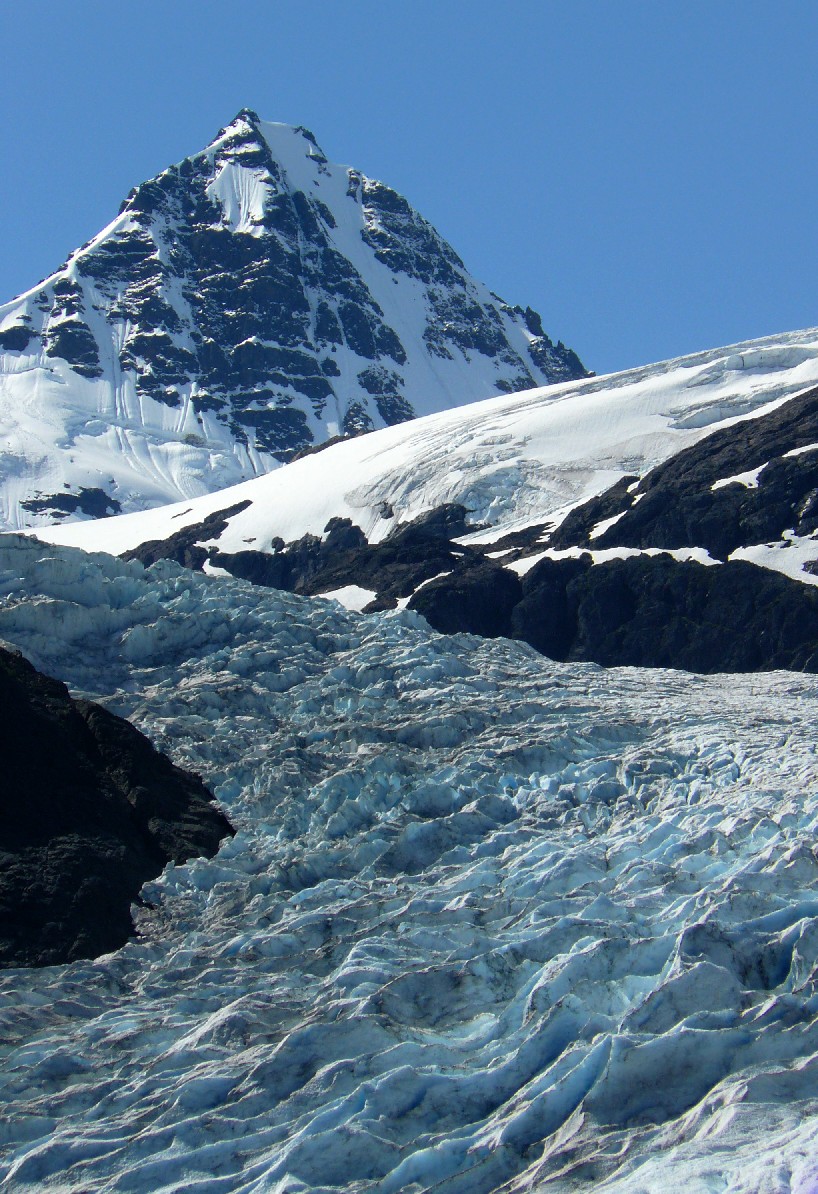
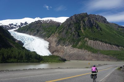
For a few days we had been hearing how beautiful the road to Stewart is. Some call it “One of BC’s most kept secrets”. It added two days of riding (65 km each way) with about 400 meters elevation gain each way. We were already on a pretty tight schedule, but decided to go for it anyway. We weren’t disappointed. Riding to Stewart was a magical experience: mountains, waterfalls and glaciers surrounded us. The Bear Glacier comes right down right to the road. The skies were blue, the sun was shining and we couldn’t ask for anything more.

Stewart, a small community of about 500 people, lies at sea level at the bottom of the valley. The combination of big mountains and the ocean is stunning. It felt to me as one of the most remote towns I’ve been to in BC. There is only one road that leads to Stewart, and if this road is blocked they are completely isolated. The closest “big” city is Terrace, about five hours away (driving).
Our first visit to Alaska was to the not so glamorous town of Hyder (population 100), which is not connected to any other place in Alaska. In Hyder we tried to catch a ride to see the Salmon Glacier, but no one stopped for us. Eventually a woman stopped, but she was not going there, she was looking for a cucumber and we joined her search. She could only find zucchinis which she didn’t want. She took us to the campground in Hyder, but the only ride we managed to catch was to a place where you supposedly see bears fishing for salmon. We didn’t stay long enough to see any bears though.

The next day we climbed back to the junction of the Cassiar. After that, the road climbed more and more and for the first time the sun was baking us. When Gili announced that he had a flat tire I wasn’t too sorry to take a rest in the shade. A nice grassy rest area appeared at the right moment to stop for the night.
The Hilly Cassiar Highway
When you are cycle touring you are affected by everything: the weather, the type of pavement or gravel, the traffic, the grade and the lines on the road. When it started raining again, we weren’t too excited about another rainy day. Also the quality of the road decreased significantly, now a collection of little stones stuck together, and in some cases not so stuck together. The lines on the road disappeared, and there were no shoulders.
At one stage it was raining so hard that we had to stop for about an hour, hiding under our tarp and praying for sun. We tried to think of all the songs we know that mention sun or summer in them, our list wasn’t very long. The day moved slowly and we could see very little views because of the low clouds, so it was a pretty boring day. Signs of civilization appeared at Bell II resort, where we had a bowl of soup to warm up, and camped in a grassy area on the shore of Little Bob Quinn Lake.

In the morning we could see mountains surrounding the lake that we couldn’t see in the evening. There were signs of improvement in the weather although there were still many clouds. That day was quite hilly as well and at the top of one of the climbs we met a truck driver on his way from Alaska to California. He had brought produce to Anchorage and was now driving back with a truck full of fresh salmon.

In the evening we reached Tatogga Lake resort. Reaching this place felt like the first little victory, since our friends Jan and Warrick had dropped off a box of food there for us which we now picked up. Finally we could relax a bit, and not riding for a day was a relief. We were exhausted – we had ridden for eight days straight, a distance of 780km without rest days. This place also had excellent food and the yummy burgers were huge. We took the next day to relax, shower, check our emails and re-organize our bags, now with 20kg more of food.

The night was clear with many stars and cold. We woke up to sunny blue skies and no clouds. It was quite ironic that the day that we added so much weight to our panniers was the day with two significant passes, with a climb of 500 meters to each one. We passed the small village of Iskut, a first nation community, it was the largest place we’d seen in days and they even had a small store. We treated ourselves to bananas and carried on. On the way we met a local guy who told us he hunts in the area, just one or two moose a year so his family will have something to eat during the long winter. We reached the first pass and from there it was a nice long descent to the Stikine River. We had lunch by the river and by the time we started climbing to the other pass it got quite hot and we were actually sweating. The first 5km of the climb were steep, and then came 30km of moderate climbing. The downhill part wasn’t so nice though. The road turned into gravel with many small rocks and it felt a bit like skiing on ice with little control of the bike.

Before we went to sleep Gili discovered a broken spoke in his rear wheel. He wasn’t very happy about it and woke up at 5am in order to fix it. The next morning we reached Dease Lake, the largest settlement in the area, with 450 people. This time we could afford to buy yogurt and apples in addition to bananas. Because of the spoke problem on Gili’s bike we now added more weight to my bike. After lunch I noticed a puncture in my rear tire which made our lunch break even longer.
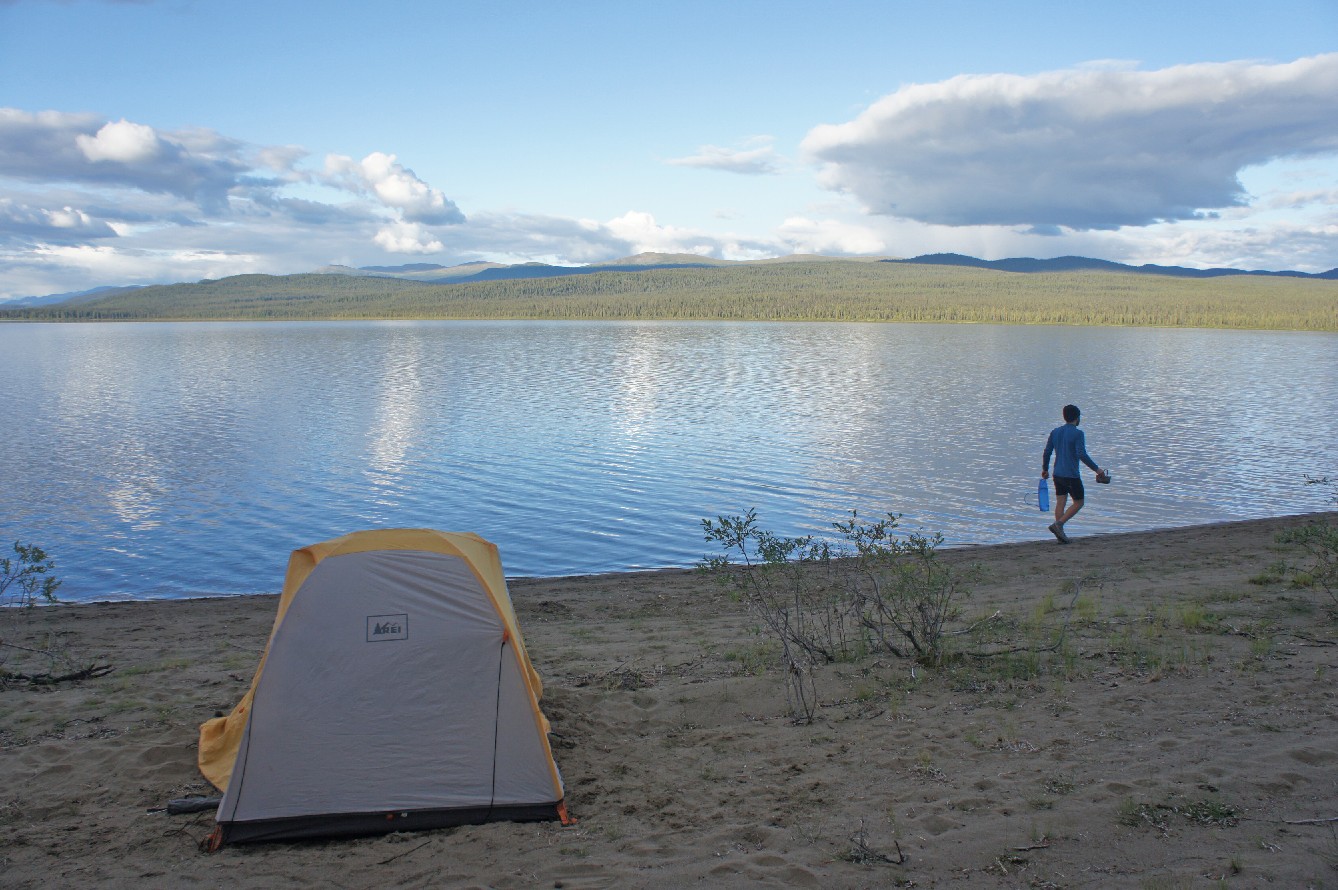
The views on the road changed all the time, from snowy mountains to brown and dry mountains. We passed many lakes, some were huge some were small, some were turquoise, blue and green. It was a real feel of remoteness. We rode for hundreds of kilometres without passing a village or any sign of civilization. The places we did pass were very small, such as Jade City (population 12). It is basically just a store, but a long time ago it was a booming mining town. Good Hope Lake is a small first nation community of 58 people. The water was turquoise, and together with the sandy beaches, the scene reminded me of Thailand. We stopped for one night at Boya Lake, which is a BC parks campground.

We met a few cyclists on the road. All of them were on much longer trip than us. The vast majority were going to Patagonia and a few were on trips from Alaska to Vancouver Island. On the last section of the Cassiar we met Monika and Robert from Switzerland. Cycling is actually their life, as they are on a round the world trip, with no finish line or end date in sight. They started from Switzerland two and a half years ago, and are now making their way slowly to Patagonia. From there they will probably catch a boat to Africa.

Into the Yukon and the Alaska Highway
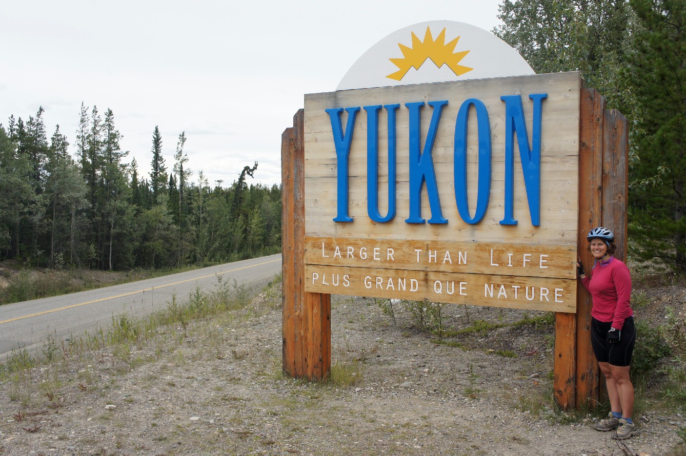
On the last day on the Cassiar we went through a long section of burnt forest which seemed recent. Then all of the sudden we were in the Yukon! There was a big sign to greet us: “Yukon, greater than life”. This part of Canada raised our curiosity. There are only 35,000 people living there in an area of 482,443 square kms, most of them are in White Horse and Dawson City and the rest in small places. Coming from a country that you can drive across in six hours, this was quite amazing.
We spent the night at the junction of the Cassiar and the Alaska Highway. It started raining in the evening and again we woke up to gray skies and drizzle. The Alaska Highway, which is mostly in Canada, was built in World War II by the US in order to connect Alaska with the lower 48. The Alaska Highway had way more traffic, but also some luxuries that come with it like road lines and shoulders. The scenery was open so we could see the road in the distance. It seemed like it’s a custom to write things with rocks on the side of the road. A few months ago a group from the VOC was driving to Skagway for a ski tour and left a VOC sign which we managed to find. As we were sitting down for lunch it started raining hard, again we pulled out our tarp, so we could enjoy our lunch.

Towards the end of the day it seems I always got a second wind, while Gili was losing his energy. It was quite nice because usually I am the slow one. We were aiming to reach Rancheria, where there is a campground, a motel, a restaurant and not much else. This was another feeling of victory as we planned to spend another well needed rest day there. We took advantage of the fact that the restaurant was still open, then we set up the tent, hung the food and collapsed.

The rest day in Rancheria was very nice. There wasn’t much to do there which was good as we could enjoy the pleasure of doing nothing. The shower was nice and warm and the people were very friendly. We spent time in the restaurant talking to the owners. The wife had mostly stories about how they ended up living there and how difficult it is to run a business in the middle of nowhere. The husband, on the other hand, shared mostly Grizzly stories. There was another guy there, a passing motorcyclist from Alaska. He was surprised that in Canada people don’t carry guns to protect themselves from the bears. One of the memorable sentences from the conversation was when he said “I’m American, so I like to carry a gun”. He also told a story in which two Grizzlies arrived to their hunting camp, they shot them, and “Rich made his Griz into a rug”.
The next section of the Alaska Highway goes into BC again and as we crossed the sun came out and shone for the rest of the day. We spent the night in Morely Lake on the border of BC and the Yukon. It was quite busy there because it was Discovery Day long weekend in the Yukon, apparently celebrating the day gold was first discovered there. Luckily there was a section on the beach that cars couldn’t get to, another advantage of traveling by bike. There was a nice family there from White Horse that invited us to sit next to the fire with them. The parents hitchhiked to the Yukon from Ontario in the 70’s and never looked back, they love living there. Another day of 100km of riding brought us to Johnson’s Crossing, the northern most point in our trip.

Two Cinnamon Buns and One Grizzly Bear
We read on a trip report that at the campground at Johnson’s Crossing there was an excellent bakery. In the morning we checked it out and had a fresh cinnamon bun. The problem was that two people we met told us that we have to try the cinnamon buns at Jake’s Corner, which is the junction where we would leave the Alaska Highway. It was 50km away which made it a perfect location for lunch. Their cinnamon buns were even better, big, gooey, and full of cinnamon. As a woman from White Horse told me, “in the place where you least expect it”.
From there we turned onto road number 8 which eventually leads to Skagway. This part was quite boring with a strong wind which made us move slowly, not much views, but also very little traffic. It had been days since we’d seen the last bear, so I kind of forgot about them. I was riding in front of Gili when a car that came from the other side stopped me and the driver said that there was a Grizzly about 150 meters away. He said he would turn around to go past the Grizzly, honk and try to scare him away. We could see the Grizzly now, and we could also see that the car and the honking made very little impression on him. The guy came back and said that that Grizzly was “bad news”. It turned out that is was a collared Grizzly, which means that he was already in contact with people, was relocated and now he’s not afraid of humans.

It seemed like we were in a big problem. Luckily this guy, Barry, was nice enough and said that he was already an hour late for dinner, so a bit longer wouldn’t hurt. He had a type of a pick up truck, but with a roof, so we shoved my bike inside, Gili’s bike on the roof, while he stood and held them and I sat in the front. The last thing I gave to Gili before we started driving was the bear spray. The bear was quite fast, and when we saw him Barry honked again. The Grizzly stood on his rear legs and groaned. He dropped us off about 4 km away and we thanked him deeply. 20km later we reached Carcross, reported the Grizzly and found a place to sleep. By now the wind picked up and it was raining.
Down to Skagway (but first up)
Skagway was now about 100km away, which is one day of riding. It felt close and far at the same time. It rained during the night and didn’t stop in the morning. The forecast didn’t seem too encouraging either. We didn’t want to spend a day in Carcross, but also weren’t excited about a day of cycling in the rain. We decided to start, and if worse came to worst, we’d stop somewhere, we still had a day to spare. The name Carcross is short for “Caribou Crossing”, but there aren’t any Caribou there any more, due to hunting.

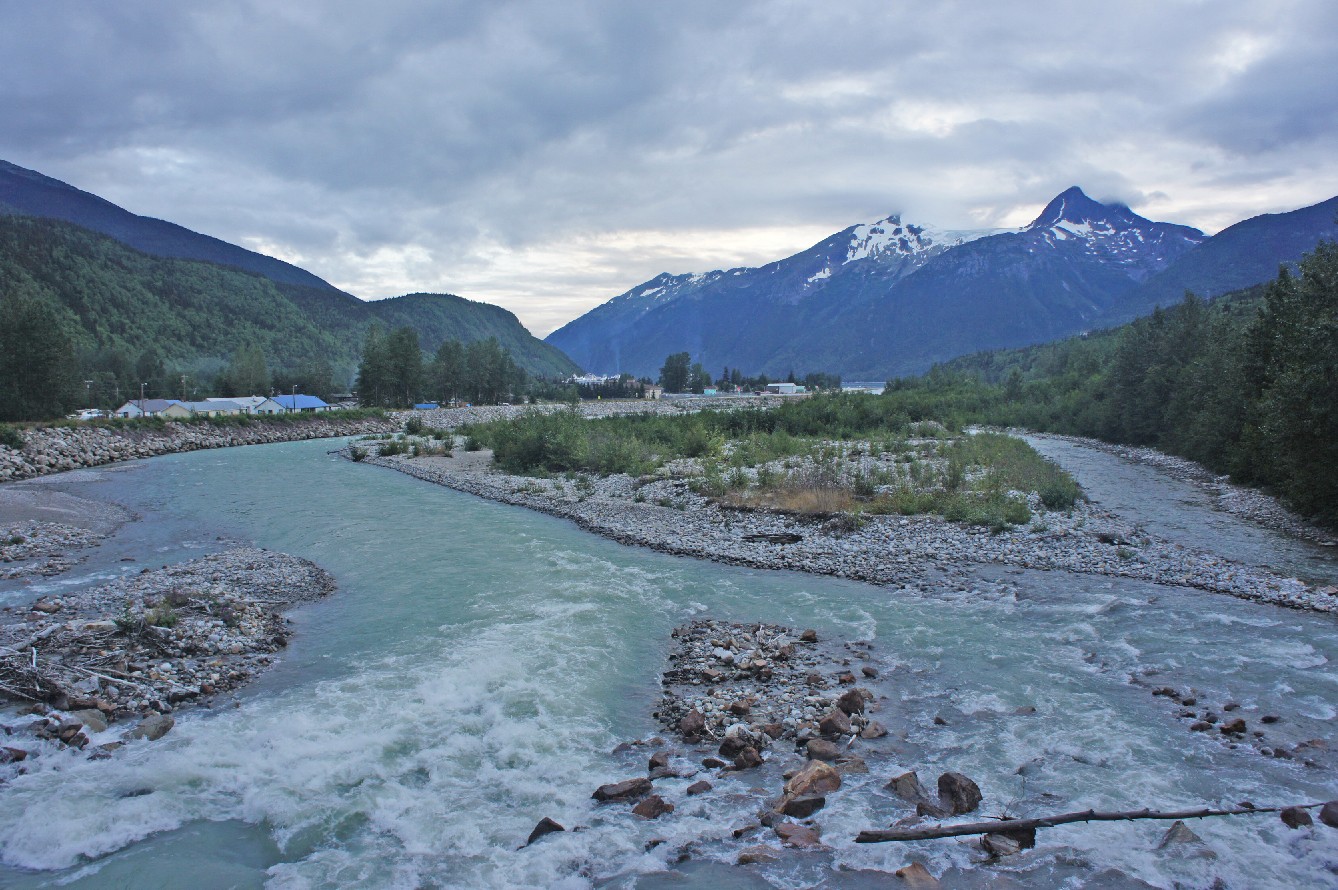
We moved slowly. It was a combination of the rain, wind, uphill and low energy and it was also very cold. A few raspberry bushes improved our mood, but not our progress. We knew that the last 24km to Skagway are all downhill but we didn’t realize how much we’d have to climb before that. Luckily by now it was raining lightly and eventually the rain stopped. Our biggest enemy that day was the wind, which was against us the whole day. But when we reached the alpine it was all worth it. The landscape was very unique, moon like. We climbed to White Pass and it felt great to reach such an impressive pass on a bike. Then on the top of the pass a sign greeted us – we were now in Alaska!

There were only 24km to go. It was freezing to go down the hill and I thought my fingers were going to fall off. The border was about halfway down the hill and was very casual. It finally got a bit warmer as we descended. The road leveled, we crossed the Skagway River and entered Skagway. It felt like a ghost town, way too big for the 700 people who actually live there year round. We found a pizza place that was still open, and ordered a large one, we rode 1632km to get there, we deserved it.

Relaxing Time
We made arrangements to couch surf with a girl who lives in Skagway and runs a tourist shop. A friend of hers from Spain was also there. It felt great to be in a home, and she was very kind and we felt very welcome. I slept on the couch and in seconds fell into a deep and worriless sleep. In the morning, when we went out to explore Skagway, it was very different than the previous night. Thousands of cruise ship tourists had taken over the town and were everywhere. Nonetheless we had a great time, ate good food, especially fresh raspberries from all the bushes around, made several visits to the supermarket and a short hike to “the point” where there are great views of the ocean and the cruise ships. We cooked dinner for our hosts and had great conversation with them about life in Spain, Alaska, Israel and Canada.

The next two days were totally relaxing. We caught the ferry back to Prince Rupert which took two days and two nights. While boarding the ferry we noticed how small it was compared to the huge cruise ships next to it. There was a casual atmosphere on the ferry and we made conversation with many people. A couple from Haines told us that they love living in Alaska because of the simplicity and the fact that there are no regulations. For example, they can fish as much as they want, as long as it is for subsistence. We also met a family from Israel with four boys who were travelling in Alaska and the Yukon. There were short talks by a ranger about topics such as glaciers, whales and different places we passed along the way. What was really nice about the ferry was the fact that there was no wireless internet. It was great seeing people doing creative things like drawing, reading books, playing games, building puzzles, making friends.

On the second evening there was a long break in Ketchikan just around dinner time. It wasn’t too far to ride to town so we decided to have dinner there. Ketchikan is the rainiest city in North America, and indeed it rained. Hard. At least we got the real experience. We arrived to Prince Rupert early in the morning and rode back to our car in the rain. As we reached the car, we closed a circle – we started in the rain, and now we were finishing in the rain, but with a lot of adventures in between. This trip was not without challenges, but it was a great experience and an excellent way to get to know Canada better, and the wonderful people who live here.