Place Glacier and Mt. Gardiner: Steep Trail and a Snowy Ridge
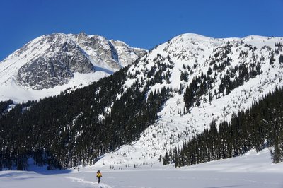
The hike up to Place Glacier was very steep with little respite for most of the 1340m elevation gain. There was a nice waterfall on the way up and some limited views backwards. Close to the end of the day we had to scramble up some slabs which would have be tricky and perhaps dangerous when wet.

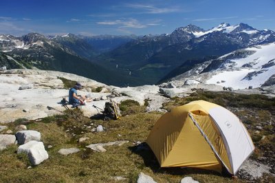
We set up camp near a lake, at the foot of the Place Glacier, with our objective for the next day, Mt. Gardiner looming above. There were also two glaciology huts nearby which we took a look at but they weren’t too interesting. We had an early dinner and watched the mountains in the sunset light, and were off to bed around 8pm. In the “middle of the night”, at about 9:30, we heard voices, after not seeing anyone the whole day. It seemed unlikely that someone had hiked up in the dark, so we didn’t know what to make of this and went back to sleep.
The next day we woke up early and I was preparing breakfast near the tent, when up comes a girl clad in down jacket and booties. What a surprise to see that this was Natalie Stafl from the VOC, there with two others to dismantle measuring instruments on the glacier for the coming winter. This explains the voices we heard the night before.

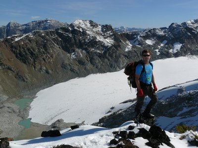
Somehow I managed to confuse Mt. Gardiner with a nearby unnamed peak, but Natalie set things straight. We set out towards Mt. Gardiner, taking a different route than the one in the book – we went west and then circled around a bump south to an unnamed lake north of Mt. Gardiner. Here we met the northeast ridge and the route in the Scrambles guidebook. I later looked up the northwest ridge and found no mention of a route up there, so perhaps it is waiting to be climbed (looks reasonable).

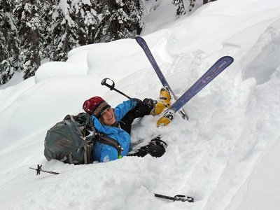
We found lots of snow on the ridge and the going was slow. There are some steeper parts that were covered by snow and felt slippery and exposed with all the snow. Nevertheless, we continued, with me scraping away the snow with gloved hands and an ice axe. When we were about five minutes away from the summit, we encountered a steeper slab covered with snow which was tricky. Maya decided she didn’t want to go up (she’s the smart one) and I went for it. I got to the summit, but at this stage there was not much satisfaction in it, and I was anticipating a very long descent. I took a few photos, made a half assed attempt to find a summit register, and headed back down. Our original plan was to scramble up this ridge and down the south ridge, thereby traversing the mountain, but we decided to descend the route we had come up.

When we got back down to the base of the summit ridge, I thought it would be faster and more direct to use the route described in the book but then cut to the camp instead of circling the lake. Either we didn’t find the correct route, or it is just a very steep and unpleasant descent. We sent down lots of rocks and finally made it down to the lake. I hurried back to camp to start packing, so when Maya arrived we had a quick late lunch and rest and headed down. We weren’t moving too fast and Maya’s legs hurt. We hiked the final hour and a half in the dark, down the steep trail in the forest, and arrived to the car just before 9pm. It was too late to grab dinner at Whistler, so we held out till Vancouver to our trustworthy all you can eat Japanese eatery (Kisha Poppo). We hurt for a few days after this one…