Washington Desert: Desert Cycling, Taco Wagons and Hot Springs
Last weekend was the Remembrance Day long weekend, and we went on a three day trip to Washington state, taking our bikes with us. The idea was to cross the Cascades and spend time in the real desert on the other side of the mountains. We waited “only” two hours at the border and continued driving south. At some stage I started feeling that the steering wheel was vibrating. We stopped at a rest area and discovered that one of our tires was flat, and much worse than that – torn. I don’t know if it tore initially, or if I drove too long on a flat and it tore that way. Anyway, I changed the tire and we drove to the nearest city, Ellensberg, where we ended up buying two almost new tires. There wasn’t much tread on the old tires, so it was just a question of when we would have to change them.

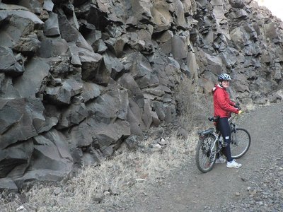
When we were done it was already in the afternoon and we had planned on doing a short hike. Nevertheless, we pushed on towards the trail head, and got great views of Mt. Adams, and perhaps a glimpse of Mt. Rainier. At the trail head we had our late traditional egg sandwich lunch. We didn’t have enough time to hike the Cowiche Canyon trail, so we decided to try and ride it, which worked very well. This trail used to be a railway and has been converted into a short hiking/cycling trail. It goes through a canyon with nice brown cliffs on both sides, and crosses many short trestle bridges. The bridges seem to be the original ones used by the train, with some planks laid on top.

In the evening we passed through Ellensberg again, where we had dinner at a “taco wagon”. These are vans with a window in the side, similar to an ice cream truck, and serve cheap Mexican food such as tacos, burritos, etc. One can get a full meal for $3-5. Typically they are somewhat hidden, so you have to work a bit to get to them behind the neon signs of Taco Bell, Taco del Mar and the likes. From there we drove to the outskirts of Vantage, the start of the cycling trip we had planned for the next day. We searched for a dark spot out of the way to park the car and go to sleep (the usual procedure for us) but it took a while since there is a large military training area there and the “no trespassing” signs were more prevalent than usual. Eventually we found a great spot, with a view down to the Columbia River, and open skies with many many stars. Then we discovered that due to a misunderstanding our toothbrushes and dental floss had made it, but the toothpaste hadn’t. Now, you must understand, I haven’t missed a brush for at least five years, so I couldn’t believe I would have to miss two just like that.

The next day we drove to the trail head which had moved relative to what was written in our guidebook, but the old signs had been left up. This left us somewhat confused, so we roamed around with the car a bit to figure out where we should start. Eventually we got our bikes out and started riding. This was another one of those railways that had been decommissioned, but this time the rail bed was sandy, it was slightly uphill and we were riding into the wind. This made for slow progress. The scenery was dry rolling hills, and the railway cut through the hills and crossed riverbeds. Eventually the sun was obscured by clouds (a Pink Floyd album) so it cooled down, and we stopped for lunch. Nice views, but many electrical lines crossing the desert. The way back was much faster than the way in. Somehow a spoke on Maya’s back wheel broke so we stopped and I tightened the adjacent spokes to compensate for the missing one.

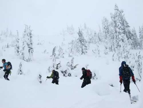
We didn’t have a set plan for the next day, so we manufactured a route that made us pass through Ellensberg, which was good both for our toothpaste situation and for the prospects of another Mexican dinner. For dinner we had burritos, the “two hand” kind, and an excellent dinner for $3.50 each. We continued our drive, now heading west across the Cascades, and as we suspected it started raining, and stayed that way through the night and the following day. Once again we found a dark spot off the road near the beginning of the trail for the next day. We woke up to rain, had breakfast and set out to find the trail head for a hike to Scenic Hot Springs. The directions didn’t seem to make sense in the beginning, but eventually we parked our car at the right spot and started hiking uphill, in the pouring rain. As we got higher we started seeing more and more snow patches, and eventually the trail was covered with a thin snow cover.

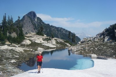
We arrived to the hot springs, checked the water to make sure it was hot enough, stripped and enjoyed the hot water and solitude. It was surreal to be in the hot water, in winter, while it was raining and snow on the ground and trees. These hot springs are on private land, but the owner allows public use of the hot springs, and there is a basic toilet and a sign with the rules. There are no signs on the road or on the trail indicating that this is the way to the hot springs, so one would have to have full directions to find it (we got them from a guidebook on hot springs). We had lunch in the water (it was still pouring) and reluctantly decided it was time to move on. Back into our damp clothes, and hiked back down to the car (in the rain, I might add..).
From there we drove to Bellingham, close to the border, where we made the traditional stop at REI. We returned Maya’s hiking boots after discovering that they were not waterproof as advertised, and I bought new boots. After a few hours there, it was time for yet another Mexican meal… This time the taco wagon was well hidden in a dark parking lot in an area full of car dealerships. This one didn’t even have a sign, and in fact there was no real indication that it was open, until we stood right next to it and someone opened the window from the inside. There was just one small plastic table next to the wagon. After another great meal (“wonder burritos”), we headed to the huge supermarket, Haggen, for the traditional after-hike ice cream. Our Ben & Jerry’s came up with the wrong price, and after a short discussion about the price, the cashier finally said that the ice cream would be free! It turns out this supermarket has a policy that if an item comes up on the cashier with the wrong price, it will be free.

As we approached the border we listened to the radio to hear the line status. They said it would be over two hours at the most popular border crossing and over an hour at the other one. When we arrived to the crossing, we were very surprised to discover that there were only two cars before us, and the whole thing took about five minutes. Definitely the shortest and most hassle free crossing of this border ever.
Directions to the Taco wagons:
Ellensberg:
Take the second exit for Ellensberg if driving west on route 90 (or the first if driving east) and drive about 4-5 traffic lights. One taco wagon is just after the KFC on the left side (try the super-burrito, $3.50), and another is not far before, just after the previous traffic light on the right side and slightly off the main road (there is an interesting looking ice cream place right after this wagon).
Bellingham:
Take exit 252 “Samish Way” as for REI. Drive on Samish, swerving with the road. Cross “Holly” and take the first legal left, it will not be at a traffic light. The street is “Champion”, and the wagon is on the left in a dark parking lot (try the wonder-burritos).
Directions to Scenic Hot Springs:
Drive 16.9km east from Skykomish on road number 2 driving towards Steven’s Pass, to a bridge over the Tye River (note: there are several bridges over the Tye River). This bridge is several kms before the pass. Continue 300m on the road driving slowly and you will find a dirt road on your right going up into the forest with no signs or indication that this is the right one. We drove up about 20-30m and parked beside a low gate blocking entrance to vehicles. From there hike up the gravel road to the power line, and start counting the electricity towers that you pass. Continue on the gravel road, until you reach the third tower which is missing an arm. Continue a little more and you will see a gravel road going up to your right. After a bit the gravel road narrows to a small trail which leads to the hot springs. Along the gravel road there are at least two shortcuts that cut out curves in the road. We got the directions from the book “Hot Springs of Western Canada” from the clubroom. This book includes a section on NW Washington. It might be a good easy snowshoeing trip.
One Comment
Pingback: